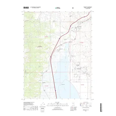
2018 Map of Washoe City
USGS Topo · Published 2018About this map
Washoe Valley defines the geography of this corridor between the Sierra Nevada and the Virginia Range, where historic communities and natural springs shaped the early development of the region. The map captures the distinct layouts of Washoe City and New Washoe City, separated by the northern reaches of the valley's wetlands and Steamboat Creek. Along the western edge, the slopes of the Toiyabe National Forest give rise to numerous drainages including Ophir Cr and Galena Cr, which historically supported timber and mining operations for the nearby Comstock Lode.
Find a feature on this map
78 named features on this map. Tap any name to fly to it.
Don’t see what you’re looking for? This feature index may not catch every label — zoom into the map to look around manually.
Map Details
Editions of this 2018 Washoe City Map
This is the sole edition of this map. No revisions or reprints were ever made.
Other maps of this area

1891 · Carson
USGS Topo · 1:125,000

1893 · Carson
USGS Topo · 1:125,000

1950 · Virginia City
USGS Topo · 1:62,500

1950 · Mt. Rose
USGS Topo · 1:62,500

1952 · Mt. Rose
USGS Topo · 1:62,500

1952 · Virginia City
USGS Topo · 1:62,500

1955 · Marlette Lake
USGS Topo · 1:24,000

1956 · Dayton
USGS Topo · 1:62,500

1956 · Carson City
USGS Topo · 1:62,500

1957 · Reno
USGS Topo · 1:250,000