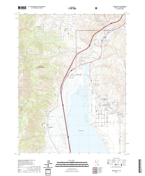
2021 Map of Washoe City
USGS Topo · Published 2021About this map
Washoe Valley anchors this high-desert landscape, with the expansive Washoe Lake serving as a focal point between the steep eastern slopes of the Toiyabe National Forest and the Steamboat Hills. The map details a mix of established residential corridors and historic sites, including the Bowers Mansion Hot Spring and the old settlement of Franktown near Franktown Creek Cemetery. This area represents a significant intersection of Nevada's early ranching and transport history, evidenced by the proximity of Washoe City and its namesake Washoe City Cemetery to the rising suburban developments of New Washoe City. Significant elevation changes are marked by features like Slide Mountain and Washoe Hill, while numerous small drainages such as Browns Creek and Jones Creek define the western alluvial fans.
Find a feature on this map
79 named features on this map. Tap any name to fly to it.
Don’t see what you’re looking for? This feature index may not catch every label — zoom into the map to look around manually.
Map Details
Editions of this 2021 Washoe City Map
This is the sole edition of this map. No revisions or reprints were ever made.
Other maps of this area

1891 · Carson
USGS Topo · 1:125,000

1893 · Carson
USGS Topo · 1:125,000

1950 · Virginia City
USGS Topo · 1:62,500

1950 · Mt. Rose
USGS Topo · 1:62,500

1952 · Mt. Rose
USGS Topo · 1:62,500

1952 · Virginia City
USGS Topo · 1:62,500

1955 · Marlette Lake
USGS Topo · 1:24,000

1956 · Dayton
USGS Topo · 1:62,500

1956 · Carson City
USGS Topo · 1:62,500

1957 · Reno
USGS Topo · 1:250,000