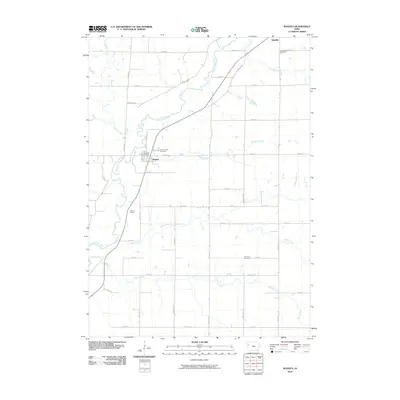
2010 Map of Washta
USGS Topo · Published 2010About this map
The Little Sioux River meanders through this agricultural landscape in Cherokee County, defining the valley where the towns of Washta and Quimby are situated. This 2010 survey illustrates a well-ordered township-and-range grid of roads such as Washta Rd and Alpine Ave, providing access to isolated homesteads and farmland. The local civic and social history is anchored by the Washta Post Office and several burial grounds, including Grandview Cemetery near Quimby and Sunset View Cemetery just outside Washta. A network of tributaries, including Willow Creek, Stratton Creek, and Bitter Creek, drains the surrounding fields into the primary river channel. Public land use is represented by the Washta Access along the riverbanks, while the presence of the Willow Rd and various numbered streets shows the modern connectivity of this rural Iowa community.
Find a feature on this map
40 named features on this map. Tap any name to fly to it.
Don’t see what you’re looking for? This feature index may not catch every label — zoom into the map to look around manually.
Map Details
Editions of this 2010 Washta Map
This is the sole edition of this map. No revisions or reprints were ever made.
Other maps of this area

1954 · Fort Dodge
USGS Topo · 1:250,000

1957 · Fort Dodge
USGS Topo · 1:250,000

1958 · Fort Dodge
USGS Topo · 1:250,000

1967 · Holstein
USGS Topo · 1:24,000

1969 · Pierson
USGS Topo · 1:24,000

1969 · Fielding
USGS Topo · 1:24,000

1969 · Correctionville
USGS Topo · 1:24,000

1969 · Cherokee South
USGS Topo · 1:24,000

1969 · Cushing
USGS Topo · 1:24,000

1969 · Quimby SE
USGS Topo · 1:24,000