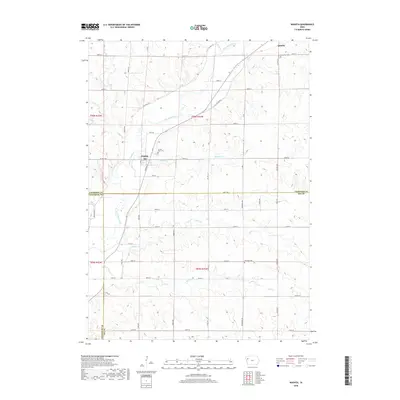
2018 Map of Washta
USGS Topo · Published 2018About this map
The Little Sioux River meanders southward through the northwest corner of Iowa, carving a valley that separates the settlements of Quimby and Washta. This 2018 survey illustrates the rural township structure at the junction of Cherokee, Woodbury, and Ida Counties. The landscape is defined by a dense network of tributaries including Stratton Cr, Ashton Cr, and Bitter Cr, which drain the surrounding agricultural uplands. Genealogists will find several significant burial sites documented, such as Sunset View Cem just north of Washta, Grandview Cem near Quimby, and the isolated Fairview Cem to the south. The proximity of these towns to the river suggests a long history of water-dependent development, while the modern grid of county roads like Co Hwy C66 and Hwy D15 maintains the connectivity of this tri-county border region.
Find a feature on this map
39 named features on this map. Tap any name to fly to it.
Don’t see what you’re looking for? This feature index may not catch every label — zoom into the map to look around manually.
Map Details
Editions of this 2018 Washta Map
This is the sole edition of this map. No revisions or reprints were ever made.
Other maps of this area

1954 · Fort Dodge
USGS Topo · 1:250,000

1957 · Fort Dodge
USGS Topo · 1:250,000

1958 · Fort Dodge
USGS Topo · 1:250,000

1967 · Holstein
USGS Topo · 1:24,000

1969 · Pierson
USGS Topo · 1:24,000

1969 · Fielding
USGS Topo · 1:24,000

1969 · Correctionville
USGS Topo · 1:24,000

1969 · Cherokee South
USGS Topo · 1:24,000

1969 · Cushing
USGS Topo · 1:24,000

1969 · Quimby SE
USGS Topo · 1:24,000