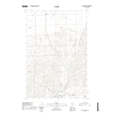
2020 Map of Washtucna North
USGS Topo · Published 2020About this map
Washtucna anchors the southern edge of this landscape, where the town's street grid meets the dramatic geologic formations of the Channeled Scablands. The area is defined by a series of prominent coulees, including Collier Coulee, Staley Coulee, and the expansive Washtucna Coulee to the south. These deep, dry canyons reflect the powerful glacial floods of the region's distant past, now hosting modern agricultural operations and transportation routes.
Find a feature on this map
30 named features on this map. Tap any name to fly to it.
Don’t see what you’re looking for? This feature index may not catch every label — zoom into the map to look around manually.
Map Details
Editions of this 2020 Washtucna North Map
This is the sole edition of this map. No revisions or reprints were ever made.
Other maps of this area

1923 · Washtucna
USGS Topo · 1:62,500

1925 · Washtucna
USGS Topo · 1:62,500

1948 · Starbuck
USGS Topo · 1:62,500

1948 · Ayer
USGS Topo · 1:62,500

1950 · Starbuck
USGS Topo · 1:62,500

1950 · Haas
USGS Topo · 1:62,500

1950 · Benge
USGS Topo · 1:62,500

1952 · Benge
USGS Topo · 1:62,500

1953 · Walla Walla
USGS Topo · 1:250,000

1958 · Walla Walla
USGS Topo · 1:250,000