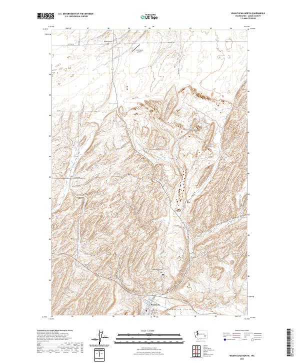
2023 Map of Washtucna North
USGS Topo · Published 2023About this map
Washtucna sits at the southern edge of this landscape, where the deeply carved channels of the Scablands define the local geography. The town is anchored by the Washtucna Pioneer Memorial Cem and serves as a waypoint for travelers and hikers on the Columbia Plateau State Park Trl. This trail follows an old rail grade through Washtucna Coulee, illustrating the historical importance of these natural corridors for transportation across the dry interior. To the north, the terrain transitions into the broad expanse of Rattlesnake Flat, punctuated by seasonal water features like Rattlesnake Lake and Bell Lake. Remote infrastructure, including the Kinch Farms Airport, highlights the agricultural nature of the region, where roads like Sage Rd and Sutton Rd navigate a complex system of dry washes such as Collier Coulee and Staley Coulee.
Find a feature on this map
28 named features on this map. Tap any name to fly to it.
Don’t see what you’re looking for? This feature index may not catch every label — zoom into the map to look around manually.
Map Details
Editions of this 2023 Washtucna North Map
This is the sole edition of this map. No revisions or reprints were ever made.
Other maps of this area

1923 · Washtucna
USGS Topo · 1:62,500

1925 · Washtucna
USGS Topo · 1:62,500

1948 · Starbuck
USGS Topo · 1:62,500

1948 · Ayer
USGS Topo · 1:62,500

1950 · Starbuck
USGS Topo · 1:62,500

1950 · Haas
USGS Topo · 1:62,500

1950 · Benge
USGS Topo · 1:62,500

1952 · Benge
USGS Topo · 1:62,500

1953 · Walla Walla
USGS Topo · 1:250,000

1958 · Walla Walla
USGS Topo · 1:250,000