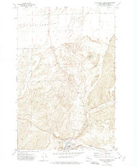
1972 Map of Washtucna North
USGS Topo · Published 1974About this map
The dry-land farming and rail hub of Washtucna sits at the southern edge of this 1972 survey, positioned at the confluence of the Washtucna Coulee and the Staley Coulee. The town is anchored by massive agricultural infrastructure, including Grain Elevators and a Storage Bin, served by both the Burlington Northern and Union Pacific railroads. This junction highlights the area's importance as a central collection point for the surrounding grain country.
Find a feature on this map
30 named features on this map. Tap any name to fly to it.
Don’t see what you’re looking for? This feature index may not catch every label — zoom into the map to look around manually.
Map Details
Editions of this 1972 Washtucna North Map
This is the sole edition of this map. No revisions or reprints were ever made.
Other maps of this area

1923 · Washtucna
USGS Topo · 1:62,500

1925 · Washtucna
USGS Topo · 1:62,500

1948 · Starbuck
USGS Topo · 1:62,500

1948 · Ayer
USGS Topo · 1:62,500

1950 · Starbuck
USGS Topo · 1:62,500

1950 · Haas
USGS Topo · 1:62,500

1950 · Benge
USGS Topo · 1:62,500

1952 · Benge
USGS Topo · 1:62,500

1953 · Walla Walla
USGS Topo · 1:250,000

1958 · Walla Walla
USGS Topo · 1:250,000