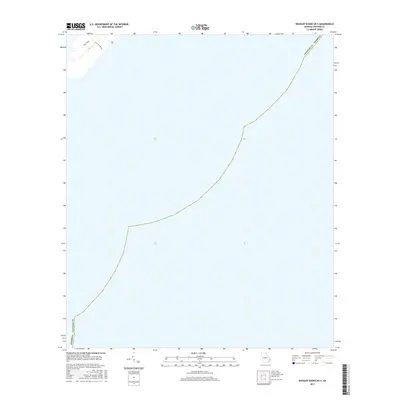
2017 Map of Wassaw Sound OE S
USGS Topo · Published 2017About this map
Main Road and the Trust Fire Break provide the only named terrestrial navigation across the northernmost tip of this coastal Georgia landscape. Located in Chatham County, this 2017 survey shows a region largely defined by the shoreline and maritime boundaries rather than dense inland development. The presence of specialized fire management infrastructure like the fire break suggests a focus on preserving the local ecosystem and managing the wooded areas within this particular coastal quadrangle. Given the scarcity of named settlements, the map serves as a detailed record of the specific access points and boundary lines that define the area's physical geography at the edge of the Atlantic.
Find a feature on this map
4 named features on this map. Tap any name to fly to it.
Don’t see what you’re looking for? This feature index may not catch every label — zoom into the map to look around manually.
Map Details
Editions of this 2017 Wassaw Sound OE S Map
This is the sole edition of this map. No revisions or reprints were ever made.
Other maps of this area

1920 · Wassaw Sound
USGS Topo · 1:62,500

1928 · St Catherines Island
USGS Topo · 1:62,500

1943 · St Catherines Island
USGS Topo · 1:62,500

1944 · Ossabaw Island
USGS Topo · 1:62,500

1945 · St. Catherine's Island
USGS Topo · 1:62,500

1945 · Ossabaw Island
USGS Topo · 1:62,500

1945 · Wassaw Sound
USGS Topo · 1:62,500

1946 · Brunswick
USGS Topo · 1:250,000

1948 · Brunswick
USGS Topo · 1:250,000

1956 · Brunswick
USGS Topo · 1:250,000