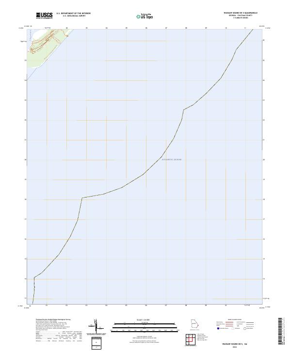
2024 Map of Wassaw Sound OE S
USGS Topo · Published 2024About this map
Wassaw National Wildlife Refuge occupies the northwestern corner of this coastal quadrangle, representing a preserved pocket of the Georgia coastline where the land meets the Atlantic Ocean. The terrain is characterized by a network of paths and access routes through the refuge, including the Main Road Trl and Trust Fire Break Trl, which provide internal navigation through the protected wilderness area. The Odingsell River defines the western edge of the landform shown, serving as a vital tidal artery within the marsh and island system. This map primarily captures the expansive maritime boundary where the coastal islands of Chatham County front the open sea, documenting the contemporary shoreline and the managed trails that allow for modern environmental stewardship within the refuge.
Find a feature on this map
5 named features on this map. Tap any name to fly to it.
Don’t see what you’re looking for? This feature index may not catch every label — zoom into the map to look around manually.
Map Details
Editions of this 2024 Wassaw Sound OE S Map
This is the sole edition of this map. No revisions or reprints were ever made.
Other maps of this area

1920 · Wassaw Sound
USGS Topo · 1:62,500

1928 · St Catherines Island
USGS Topo · 1:62,500

1943 · St Catherines Island
USGS Topo · 1:62,500

1944 · Ossabaw Island
USGS Topo · 1:62,500

1945 · St. Catherine's Island
USGS Topo · 1:62,500

1945 · Ossabaw Island
USGS Topo · 1:62,500

1945 · Wassaw Sound
USGS Topo · 1:62,500

1946 · Brunswick
USGS Topo · 1:250,000

1948 · Brunswick
USGS Topo · 1:250,000

1956 · Brunswick
USGS Topo · 1:250,000