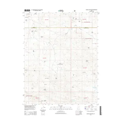
2014 Map of Water Canyon Peak
USGS Topo · Published 2014About this map
Water Canyon Peak stands as the primary landmark in this corner of the Dixie National Forest along the high boundary between Iron and Washington counties. The landscape is defined by its drainages and high flats, where Rock Hole Wash and Shoal Cr carve paths through the terrain. The presence of numerous named water sources like Terry Spring, Nephi Spring, and Rattlesnake Spring highlights the vital importance of these points in an arid environment. Historical movement across the high country is evidenced by the Old Modena Rd and the crossing at West Pass. To the southeast, the Upper Enterprise Reservoir indicates modern water management, while labels like Mud Flat and Colie Flat describe the varied topography that transitions from peaks to low basins. This 2014 survey captures the persistence of traditional land names and ranching-related geography in the Utah wilderness.
Find a feature on this map
43 named features on this map. Tap any name to fly to it.
Don’t see what you’re looking for? This feature index may not catch every label — zoom into the map to look around manually.
Map Details
Editions of this 2014 Water Canyon Peak Map
This is the sole edition of this map. No revisions or reprints were ever made.
Other maps of this area

1885 · St. George
USGS Topo · 1:250,000

1885 · Pioche
USGS Topo · 1:250,000

1886 · Pioche
USGS Topo · 1:250,000

1891 · St. George
USGS Topo · 1:250,000

1953 · Cedar City
USGS Topo · 1:250,000

1954 · Caliente
USGS Topo · 1:250,000

1958 · Cedar City
USGS Topo · 1:250,000

1958 · Docs Pass
USGS Topo · 1:24,000

1959 · Caliente
USGS Topo · 1:250,000

1962 · Cedar City
USGS Topo · 1:250,000