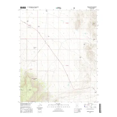
2017 Map of Water Canyon
USGS Topo · Published 2017About this map
Cibola National Forest defines the southwestern portion of this landscape, where the rising elevations of the Magdalena Mountains and Water Canyon Mesa create a dramatic contrast with the arid basins to the northeast. This 2017 study illustrates a network of ephemeral drainage systems, most notably the Nogal Arroyo, which carries seasonal runoff from the higher peaks. Human transit is centered on the long diagonal of Grant Rd and the service routes of Water Canyon Rd and Forest 505 Rd, providing access to the more remote mountainous terrain.
Find a feature on this map
25 named features on this map. Tap any name to fly to it.
Don’t see what you’re looking for? This feature index may not catch every label — zoom into the map to look around manually.
Map Details
Editions of this 2017 Water Canyon Map
This is the sole edition of this map. No revisions or reprints were ever made.
Other maps of this area

1906 · Socorro
USGS Topo · 1:62,500

1916 · La Joya
USGS Topo · 1:125,000

1948 · San Antonio
USGS Topo · 1:62,500

1954 · Tularosa
USGS Topo · 1:250,000

1954 · Socorro
USGS Topo · 1:250,000

1958 · Socorro
USGS Topo · 1:250,000

1958 · Tularosa
USGS Topo · 1:250,000

1959 · Socorro
USGS Topo · 1:24,000

1959 · Lemitar
USGS Topo · 1:24,000

1959 · Magdalena
USGS Topo · 1:62,500