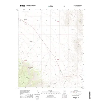
2020 Map of Water Canyon
USGS Topo · Published 2020About this map
The Magdalena Mountains dominate the southwestern quadrant of this Socorro County landscape, where the high terrain of Water Canyon Mesa falls away into the Cibola National Forest. The geography is defined by a series of steep drainages including Nogal Canyon, Garcia Canyon, and Shakespeare Canyon, which cut through the arid uplands toward the Nogal Arroyo. Modern access is provided by Grant Rd and the Kokopelli Loop, tracing paths through the high desert floor.
Find a feature on this map
25 named features on this map. Tap any name to fly to it.
Don’t see what you’re looking for? This feature index may not catch every label — zoom into the map to look around manually.
Map Details
Editions of this 2020 Water Canyon Map
This is the sole edition of this map. No revisions or reprints were ever made.
Other maps of this area

1906 · Socorro
USGS Topo · 1:62,500

1916 · La Joya
USGS Topo · 1:125,000

1948 · San Antonio
USGS Topo · 1:62,500

1954 · Tularosa
USGS Topo · 1:250,000

1954 · Socorro
USGS Topo · 1:250,000

1958 · Socorro
USGS Topo · 1:250,000

1958 · Tularosa
USGS Topo · 1:250,000

1959 · Socorro
USGS Topo · 1:24,000

1959 · Lemitar
USGS Topo · 1:24,000

1959 · Magdalena
USGS Topo · 1:62,500