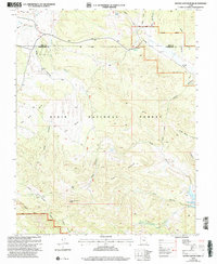
2002 Map of Water Canyon
USGS Topo · Published 2005About this map
The high-desert terrain of the Dixie National Forest dominates this landscape, where the administrative boundary of the Pine Valley Ranger District meets the county line between Iron and Washington Counties. Natural water sources are critical features of this environment, with remote points like Nephi Spring, Terry Spring, and the curiously named Corral Dads Spring dotting the drainages. The map reveals a land utilized for cattle and transit, evidenced by the Rock Hole Corral and numerous 4wd tracks that negotiate the breaks between Panaca Ridge and Green Mountain. To the southeast, the Upper Enterprise Reservoir provides a substantial catchment at the terminus of Pine Canyon, while the prominent Water Canyon Peak serves as a primary landmark above the surrounding flats and hollows.
Find a feature on this map
30 named features on this map. Tap any name to fly to it.
Don’t see what you’re looking for? This feature index may not catch every label — zoom into the map to look around manually.
Map Details
Editions of this 2002 Water Canyon Map
This is the sole edition of this map. No revisions or reprints were ever made.
Other maps of this area

1885 · St. George
USGS Topo · 1:250,000

1885 · Pioche
USGS Topo · 1:250,000

1886 · Pioche
USGS Topo · 1:250,000

1891 · St. George
USGS Topo · 1:250,000

1953 · Cedar City
USGS Topo · 1:250,000

1954 · Caliente
USGS Topo · 1:250,000

1958 · Cedar City
USGS Topo · 1:250,000

1958 · Docs Pass
USGS Topo · 1:24,000

1959 · Caliente
USGS Topo · 1:250,000

1962 · Cedar City
USGS Topo · 1:250,000