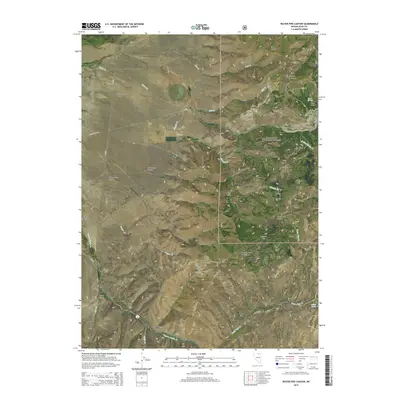
2015 Map of Water Pipe Canyon
USGS Topo · Published 2015About this map
The Independence Mountains dominate this high-altitude Nevada landscape, where the peaks of Wheeler Mtn rise sharply above the Humboldt National Forest. The eastern half of the map is defined by a dense network of drainages and canyons, including Water Pipe Canyon, Steer Canyon, and the appropriately named Starvation Canyon. These corridors channel water from the heights into various creeks such as Water Pipe Cr and Schmidt Cr.
Find a feature on this map
36 named features on this map. Tap any name to fly to it.
Don’t see what you’re looking for? This feature index may not catch every label — zoom into the map to look around manually.
Map Details
Editions of this 2015 Water Pipe Canyon Map
This is the sole edition of this map. No revisions or reprints were ever made.
Other maps of this area

1955 · McDermitt
USGS Topo · 1:250,000

1955 · Wells
USGS Topo · 1:250,000

1956 · Tuscarora
USGS Topo · 1:62,500

1958 · Wells
USGS Topo · 1:250,000

1959 · McDermitt
USGS Topo · 1:250,000

1961 · Wells
USGS Topo · 1:250,000

1970 · Lake Mountain
USGS Topo · 1:24,000

1970 · Stampede Ranch
USGS Topo · 1:24,000

1971 · Mahala Creek West
USGS Topo · 1:24,000

1971 · California Mtn.
USGS Topo · 1:24,000