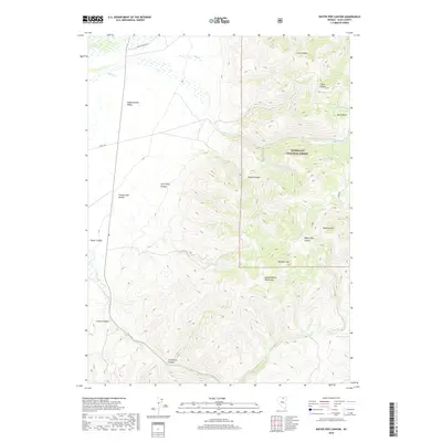
2018 Map of Water Pipe Canyon
USGS Topo · Published 2018About this map
The Independence Mountains dominate this Elko County landscape, where deep drainages like Water Pipe Canyon and Starvation Canyon carve through high desert terrain. Within the Humboldt National Forest, the topography rises sharply to Wheeler Mtn, creating a dramatic vertical contrast with the broad Independence Valley to the west. This area is characterized by a sparse network of roads, such as Wright Ranch Rd and Altosc Rd, which provide access to family-named landmarks including Thomas Jose Canyon and Jack Henry Canyon. The presence of several seasonal water sources, including Burns Cr and Dry Cr, as well as Barrel Spring and Willow Spring, highlights the importance of localized water for ranching and forest management in this arid Nevada interior.
Find a feature on this map
27 named features on this map. Tap any name to fly to it.
Don’t see what you’re looking for? This feature index may not catch every label — zoom into the map to look around manually.
Map Details
Editions of this 2018 Water Pipe Canyon Map
This is the sole edition of this map. No revisions or reprints were ever made.
Other maps of this area

1955 · McDermitt
USGS Topo · 1:250,000

1955 · Wells
USGS Topo · 1:250,000

1956 · Tuscarora
USGS Topo · 1:62,500

1958 · Wells
USGS Topo · 1:250,000

1959 · McDermitt
USGS Topo · 1:250,000

1961 · Wells
USGS Topo · 1:250,000

1970 · Lake Mountain
USGS Topo · 1:24,000

1970 · Stampede Ranch
USGS Topo · 1:24,000

1971 · Mahala Creek West
USGS Topo · 1:24,000

1971 · California Mtn.
USGS Topo · 1:24,000