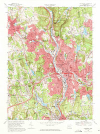
1968 Map of Waterbury
USGS Topo · Published 1971About this map
The Naugatuck River corridor anchors this 1968 revision, serving as the industrial and transportation spine for Waterbury and its surrounding hill settlements. The map illustrates a dense mid-century urban landscape, where residential neighborhoods like Town Plot Hill and Overlook are closely integrated with numerous parochial and public institutions, including Notre Dame Academy and the University of Connecticut Waterbury Branch. To the northwest, Watertown maintains a distinct character, defined by the campus of the Taft School and the Evergreen Cemetery.
Find a feature on this map
261 named features on this map. Tap any name to fly to it.
Don’t see what you’re looking for? This feature index may not catch every label — zoom into the map to look around manually.
Map Details
Editions of this 1968 Waterbury Map
4 editions found
Other maps of this area

1889 · Derby
USGS Topo · 1:62,500

1891 · Derby
USGS Topo · 1:62,500

1892 · New Haven
USGS Topo · 1:62,500

1892 · Meriden
USGS Topo · 1:62,500

1893 · Waterbury
USGS Topo · 1:62,500

1893 · Meriden
USGS Topo · 1:62,500

1893 · Derby
USGS Topo · 1:62,500

1904 · Waterbury
USGS Topo · 1:62,500

1904 · Litchfield
USGS Topo · 1:125,000

1906 · Farmington
USGS Topo · 1:125,000