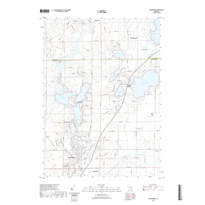
2018 Map of Waterford
USGS Topo · Published 2018About this map
The Fox River winds through a landscape defined by glacial lakes and a sophisticated network of 21st-century water management. Settlements like Waterford, Tichigan, and Wind Lake anchor the region, illustrating the dense residential development surrounding the area's numerous water bodies. The presence of the Wind Lake Drainage Canal, Goose Lake Branch Canal, and Muskego Canal reveals a highly engineered hydrologic system designed to manage water levels across the low-lying terrain between Muskego Lake and the river valley.
Find a feature on this map
143 named features on this map. Tap any name to fly to it.
Don’t see what you’re looking for? This feature index may not catch every label — zoom into the map to look around manually.
Map Details
Editions of this 2018 Waterford Map
This is the sole edition of this map. No revisions or reprints were ever made.
Other maps of this area

1891 · Muskego
USGS Topo · 1:62,500

1892 · Eagle
USGS Topo · 1:62,500

1893 · Silver Lake
USGS Topo · 1:62,500

1893 · Geneva
USGS Topo · 1:62,500

1894 · Eagle
USGS Topo · 1:62,500

1897 · Eagle
USGS Topo · 1:62,500

1901 · Muskego
USGS Topo · 1:62,500

1904 · Lake Geneva
USGS Topo · 1:62,500

1906 · Eagle
USGS Topo · 1:62,500

1906 · Silver Lake
USGS Topo · 1:62,500