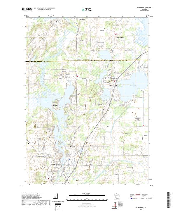
2022 Map of Waterford
USGS Topo · Published 2022About this map
The Fox River meanders through the heart of this Racine County landscape, connecting the lakeside communities of Tichigan and Waterford. This survey captures a region defined by its dense network of waterways and drainage infrastructure, including the Wind Lake Drainage Canal and the Goose Lake Branch Canal. These features highlight the historic management of the low-lying wetlands surrounding Wind Lake, Lake Denoon, and Waubeesee Lake. Genealogists will find significant local value in the mapped locations of Rural Home Cem, Saint Peters Lutheran Cem, and Saint Thomas Aquinas Cem. The map also details the transition from small settlements like Rochester and Buena Park to more established centers, while landmarks such as Horner Farms Airport point to the area's specialized local infrastructure alongside the winding Big Bend Dr.
Find a feature on this map
150 named features on this map. Tap any name to fly to it.
Don’t see what you’re looking for? This feature index may not catch every label — zoom into the map to look around manually.
Map Details
Editions of this 2022 Waterford Map
This is the sole edition of this map. No revisions or reprints were ever made.
Other maps of this area

1891 · Muskego
USGS Topo · 1:62,500

1892 · Eagle
USGS Topo · 1:62,500

1893 · Silver Lake
USGS Topo · 1:62,500

1893 · Geneva
USGS Topo · 1:62,500

1894 · Eagle
USGS Topo · 1:62,500

1897 · Eagle
USGS Topo · 1:62,500

1901 · Muskego
USGS Topo · 1:62,500

1904 · Lake Geneva
USGS Topo · 1:62,500

1906 · Eagle
USGS Topo · 1:62,500

1906 · Silver Lake
USGS Topo · 1:62,500