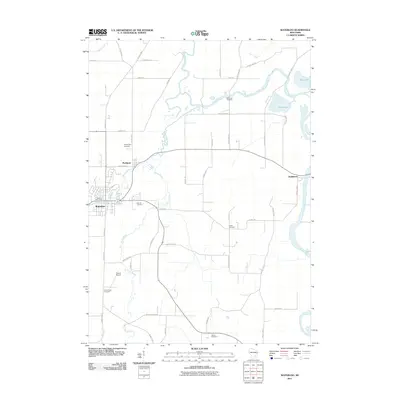
2011 Map of Waterloo
USGS Topo · Published 2011About this map
The Crawfish River and its meandering tributaries dominate this Jefferson County landscape, shaping the rural development of eastern Wisconsin as it appeared in the early 21st century. The settlement of Waterloo serves as a primary hub in the southwest, featuring the Waterloo Post Office and nearby Tesmer Airport. To the north and east, the smaller communities of Portland and Hubbleton are connected by a network of county highways and local roads that navigate the marshy terrain surrounding Mud Lake and Chub Lake. Local genealogy and land-use history are well-preserved through numerous burial grounds, including the Moravian Cemetery and Oak Hill Cemetery. The mapping of Stony Brook and Maunesha River illustrates how these waterways influenced the layout of farms and road placements like Island Rd and Blue Joint Rd.
Find a feature on this map
50 named features on this map. Tap any name to fly to it.
Don’t see what you’re looking for? This feature index may not catch every label — zoom into the map to look around manually.
Map Details
Editions of this 2011 Waterloo Map
This is the sole edition of this map. No revisions or reprints were ever made.
Other maps of this area

1890 · Sun Prairie
USGS Topo · 1:62,500

1891 · Waterloo
USGS Topo · 1:62,500

1894 · Waterloo
USGS Topo · 1:62,500

1896 · Sun Prairie
USGS Topo · 1:62,500

1905 · Sun Prairie
USGS Topo · 1:62,500

1907 · Sun Prairie
USGS Topo · 1:62,500

1910 · Waterloo
USGS Topo · 1:62,500

1955 · Columbus
USGS Topo · 1:62,500

1955 · Beaver Dam
USGS Topo · 1:62,500

1957 · Madison
USGS Topo · 1:250,000