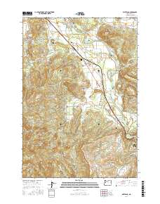
2017 Map of Waterloo
USGS Topo · Published 2017About this map
The South Santiam River winds through this landscape in Linn County, anchoring a series of small rural communities and family-named landmarks. The terrain transitions from the river valley floor near Waterloo and Fairview toward the higher elevations of Marks Ridge and Scott Mtn. This geography historically dictated the placement of early settlements and transportation routes like the Old Santiam Hwy and Berlin Rd. Genealogists will find significant local history preserved in the Klum Cem, Linn Memorial Cem, and Liberty Cem. The map reveals the intricate network of water resources that supported these communities, from the Durlam Reservoir to smaller tributaries like Vail Cr and Noble Cr, illustrating how the drainage of the Cascades foothills shaped the development of Sodaville and the outskirts of Sweet Home.
Find a feature on this map
76 named features on this map. Tap any name to fly to it.
Don’t see what you’re looking for? This feature index may not catch every label — zoom into the map to look around manually.
Map Details
Editions of this 2017 Waterloo Map
This is the sole edition of this map. No revisions or reprints were ever made.
Other maps of this area

1911 · Brownsville
USGS Topo · 1:31,680

1911 · Lebanon
USGS Topo · 1:31,680

1921 · Brownsville
USGS Topo · 1:62,500

1921 · Lebanon
USGS Topo · 1:62,500

1922 · Lebanon
USGS Topo · 1:48,000

1924 · Lebanon
USGS Topo · 1:62,500

1940 · Lebanon
USGS Topo · 1:62,500

1944 · Lebanon
USGS Topo · 1:62,500

1950 · Brownsville
USGS Topo · 1:62,500

1951 · Sweet Home
USGS Topo · 1:62,500