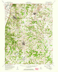
1955 Map of Waterloo
USGS Topo · Published 1960About this map
The American Bottoms floodplains meet the rising bluffs of Sugar Loaf in this mid-century portrait of Monroe and St. Clair counties. The landscape is defined by a dense network of small agrarian settlements and rural education sites, such as Saxtown Sch, High Prairie Sch, and Vogel Sch. The county seat of Waterloo serves as a central hub, while the Gulf Pacific and Ohio RR and Missouri Pacific RR facilitate the movement of goods through Dupo and Millstadt Junction.
Find a feature on this map
89 named features on this map. Tap any name to fly to it.
Don’t see what you’re looking for? This feature index may not catch every label — zoom into the map to look around manually.
Map Details
Editions of this 1955 Waterloo Map
This is the sole edition of this map. No revisions or reprints were ever made.
Other maps of this area

1888 · St. Louis
USGS Topo · 1:62,500

1907 · Belleville
USGS Topo · 1:62,500

1910 · Waterloo
USGS Topo · 1:62,500

1912 · New Athens
USGS Topo · 1:62,500

1912 · Kimmswick
USGS Topo · 1:62,500

1912 · Baldwin
USGS Topo · 1:62,500

1913 · Waterloo
USGS Topo · 1:62,500

1914 · Baldwin
USGS Topo · 1:62,500

1915 · Renault
USGS Topo · 1:62,500

1915 · Crystal City
USGS Topo · 1:62,500