
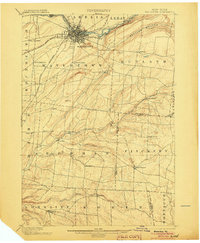
1898 Map of Watertown
USGS Topo · Published 1898About this map
Watertown serves as the industrial and transportation hub on this 1898 sheet, situated at the bend of the Black River where several branches of the R. W. & O. R. R. converge. The surrounding landscape in Jefferson and Lewis counties is defined by a dense network of small agrarian hamlets and mills that supported the local economy before the shift toward larger urban centers. Many of these settlements, such as Burrs Mills, Fields Settlement, and Honeyville, were positioned along watercourses like Mill Creek or near prominent geological formations such as The Ridge. To the northeast, the distinct topography of Rutland Hollow creates a natural corridor through the hills. This survey captures the region's transition from a rural frontier of scattered family-named landmarks like Tremaines and Cronk Corner to a more integrated rail-and-river network focused on the growing manufacturing center at the falls of the Black River.
Find a feature on this map
53 named features on this map. Tap any name to fly to it.
Don’t see what you’re looking for? This feature index may not catch every label — zoom into the map to look around manually.
Map Details
Editions of this 1898 Watertown Map
2 editions found
Other maps of this area

1893 · Sackets Harbor
USGS Topo · 1:62,500

1895 · Sacketts Harbor
USGS Topo · 1:62,500

1895 · Pulaski
USGS Topo · 1:62,500

1895 · Watertown
USGS Topo · 1:62,500

1900 · Clayton
USGS Topo · 1:62,500

1902 · Carthage
USGS Topo · 1:62,500

1903 · Clayton
USGS Topo · 1:62,500

1903 · Theresa
USGS Topo · 1:62,500

1903 · Orwell
USGS Topo · 1:62,500

1904 · Carthage
USGS Topo · 1:62,500