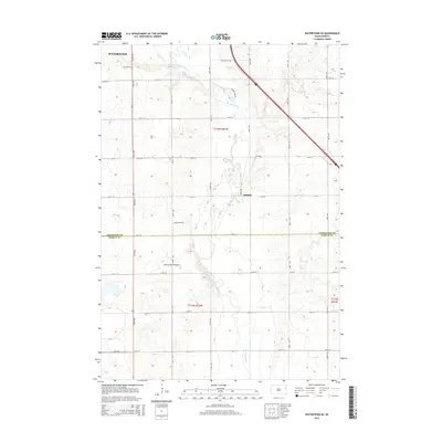
2015 Map of Watertown SE
USGS Topo · Published 2015About this map
The Coteau des Prairies plateau dominates this section of eastern South Dakota, where the Big Sioux River meanders southward through a landscape of glacial upland and agricultural section lines. Just southeast of the expanding city of Watertown, the map captures the transition from urban outskirts to rural township life. The small settlement of Appleby sits along 458th Ave, serving as a landmark in a region defined by its water-carved topography and high-ground ridges. Local drainage is further defined by Willow Cr, which feeds into the larger river system near the northern boundary. The grid of roads, including Angel Ridge Rd and Meadow Lake Rd, provides a clear view of how the land was partitioned and settled across the Codington and Hamlin County line during the early twenty-first century.
Find a feature on this map
27 named features on this map. Tap any name to fly to it.
Don’t see what you’re looking for? This feature index may not catch every label — zoom into the map to look around manually.
Map Details
Editions of this 2015 Watertown SE Map
This is the sole edition of this map. No revisions or reprints were ever made.
Other maps of this area

1953 · Watertown
USGS Topo · 1:250,000

1958 · Watertown
USGS Topo · 1:250,000

1969 · Hayti
USGS Topo · 1:24,000

1969 · Dempster
USGS Topo · 1:24,000

1969 · Castlewood
USGS Topo · 1:24,000

1969 · Watertown West
USGS Topo · 1:24,000

1969 · Pelican Lake
USGS Topo · 1:24,000

1969 · Watertown SE
USGS Topo · 1:24,000

1969 · Watertown East
USGS Topo · 1:24,000

1970 · Kranzburg SW
USGS Topo · 1:24,000