
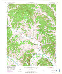
1953 Map of Waterview
USGS Topo · Published 1954About this map
Cumberland River curves sharply through this landscape, defining the dramatic Salt Lick Bend and providing a waterway for the transit-dependent communities of the early 1950s. The county seat of Burkesville sits perched on the eastern bluffs, while river access points like Cloyds Landing and the Oliver Ferry crossing indicate the vital importance of the river before the modern bridge network was fully realized.
Find a feature on this map
39 named features on this map. Tap any name to fly to it.
Don’t see what you’re looking for? This feature index may not catch every label — zoom into the map to look around manually.
Map Details
Editions of this 1953 Waterview Map
2 editions found
Other maps of this area

1924 · Lillydale
USGS Topo · 1:62,500

1926 · Lillydale
USGS Topo · 1:62,500

1929 · Lillydale
USGS Topo · 1:62,500

1929 · Tompkinsville
USGS Topo · 1:62,500

1953 · Breeding
USGS Topo · 1:24,000

1953 · Edmonton
USGS Topo · 1:24,000

1953 · Amandaville
USGS Topo · 1:24,000

1953 · Burkesville
USGS Topo · 1:24,000

1953 · Dubre
USGS Topo · 1:24,000

1954 · Frogue
USGS Topo · 1:24,000