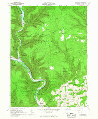
1965 Map of Waterville
USGS Topo · Published 1967About this map
Waterville sits at the confluence of Little Pine Creek and the larger Pine Creek, serving as a central point in this mid-1960s landscape. Much of the surrounding terrain is preserved within the Tiadaghton State Forest, where steep elevations like Houselander Mountain and Puterbaugh Mountain rise above the deep cut of the Central Gorge. The map documents a mix of wilderness and small-scale development, from the Little Pine Dam and its associated picnic area in the north to the small settlements of Ramsey and Tombs Run further south. Transportation and infrastructure are represented by the New York Central rail line tracing the creek's curve and a prominent Pipeline cutting across the southern ridges. Local community life is anchored by landmarks such as Mt Pleasant Ch and Centennial Ch, providing valuable touchpoints for genealogists researching families in the Cummings, Watson, and Mifflin townships.
Find a feature on this map
63 named features on this map. Tap any name to fly to it.
Don’t see what you’re looking for? This feature index may not catch every label — zoom into the map to look around manually.
Map Details
Editions of this 1965 Waterville Map
2 editions found
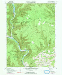
Other maps of this area

1921 · Williamsport
USGS Topo · 1:48,000

1921 · Trout Run
USGS Topo · 1:62,500

1921 · Lock Haven
USGS Topo · 1:62,500

1923 · Lock Haven
USGS Topo · 1:62,500

1923 · Trout Run
USGS Topo · 1:62,500

1923 · Williamsport
USGS Topo · 1:62,500

1935 · Waterville
USGS Topo · 1:24,000

1937 · Waterville
USGS Topo · 1:48,000

1943 · Waterville
USGS Topo · 1:62,500

1944 · Trout Run
USGS Topo · 1:62,500
Featured Places
- Mifflin Township, PA
- Cogan House Township, PA
- Watson Township, PA
- Ramsey, Cummings Township
- English Mills, Cummings Township