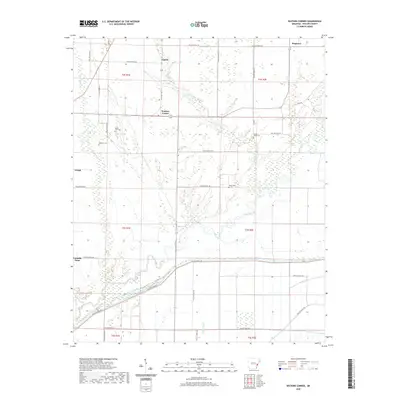
2020 Map of Watkins Corner
USGS Topo · Published 2020About this map
Big Creek and its many meandering tributaries define this low-lying portion of Phillips County, where the landscape is etched by a complex network of seasonal sloughs and drainage channels. Rural life centers on small crossroads like Watkins Corner and Cypert, connected by a grid of Phillips County roads such as Phillips Road 376 and Phillips Road 631. For those researching local family history, the map provides precise locations for several small burial grounds, including Mount Zion Cem and Lightfoot Cem near Cargo Slough. The distribution of these cemeteries alongside quiet settlements like Connells Point and Kingtown reflects the long-standing agricultural communities that have worked this delta land for generations. The presence of Jessie Slough and Little Cypress Cr illustrates the delicate water table of this alluvial plain.
Find a feature on this map
46 named features on this map. Tap any name to fly to it.
Don’t see what you’re looking for? This feature index may not catch every label — zoom into the map to look around manually.
Map Details
Editions of this 2020 Watkins Corner Map
This is the sole edition of this map. No revisions or reprints were ever made.
Other maps of this area

1939 · Modoc
USGS Topo · 1:62,500

1939 · Indian Bay
USGS Topo · 1:62,500

1940 · Marvell
USGS Topo · 1:62,500

1940 · Holly Grove
USGS Topo · 1:62,500

1948 · Helena
USGS Topo · 1:250,000

1948 · Modoc
USGS Topo · 1:62,500

1950 · Helena
USGS Topo · 1:250,000

1954 · Indian Bay
USGS Topo · 1:62,500

1955 · Helena
USGS Topo · 1:250,000

1956 · Marvell
USGS Topo · 1:62,500