
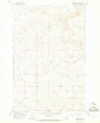
1965 Map of Watkins SE
USGS Topo · Published 1968About this map
The high plains of eastern Montana are captured here during the mid-1960s, showing a landscape defined by expansive ranch lands and intermittent waterways. The terrain is dominated by the prominence of Big Sheep Mountain Road, which traverses the high ground through the heart of the quadrangle. Water sources are critical but sparse in this environment, represented by the winding course of Lisk Creek and the small West Duck Cr to the north. A vital landmark for local history and livestock is Morton Spring, located near the boundary between Mc Cone Co and Prairie Co. This survey illustrates the specialized infrastructure of Big Sky Country, where roads follow the natural ridges and life centers around the few permanent water points in a wide, open territory.
Find a feature on this map
6 named features on this map. Tap any name to fly to it.
Don’t see what you’re looking for? This feature index may not catch every label — zoom into the map to look around manually.
Map Details
Editions of this 1965 Watkins SE Map
This is the sole edition of this map. No revisions or reprints were ever made.
Other maps of this area

1953 · Miles City
USGS Topo · 1:250,000

1954 · Glendive
USGS Topo · 1:250,000

1957 · Miles City
USGS Topo · 1:250,000

1957 · Glendive
USGS Topo · 1:250,000

1958 · Miles City
USGS Topo · 1:250,000

1958 · Glendive
USGS Topo · 1:250,000

1965 · Little Sheep Mountain
USGS Topo · 1:24,000

1965 · Heitz School
USGS Topo · 1:24,000
1965 · Combs Ranch
USGS Topo · 1:24,000

1965 · Watkins
USGS Topo · 1:24,000