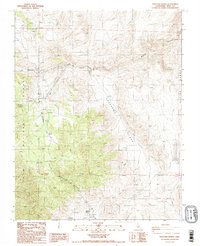
1987 Map of Waucoba Spring
USGS Topo · Published 1987About this map
Opal Mine and numerous unnamed prospects characterize this high-desert landscape in Inyo County during the late 20th century. Most of the terrain is situated within the Inyo National Forest, where steep ridges and deep drainages define the topography. The map reveals a network of canyons, most notably Marble Canyon and Opal Canyon, which cut through the uplifted terrain toward broader basins like Jackass Flats.
Find a feature on this map
16 named features on this map. Tap any name to fly to it.
Don’t see what you’re looking for? This feature index may not catch every label — zoom into the map to look around manually.
Map Details
Editions of this 1987 Waucoba Spring Map
2 editions found
Other maps of this area

1907 · Mt. Whitney
USGS Topo · 1:125,000

1908 · Lida
USGS Topo · 1:250,000

1908 · Ballarat
USGS Topo · 1:250,000

1913 · Bishop
USGS Topo · 1:125,000

1913 · Lida
USGS Topo · 1:250,000

1913 · Ballarat
USGS Topo · 1:250,000

1919 · Mt. Whitney
USGS Topo · 1:125,000

1937 · Mt. Whitney
USGS Topo · 1:125,000

1947 · Mariposa
USGS Topo · 1:250,000

1948 · Death Valley
USGS Topo · 1:250,000