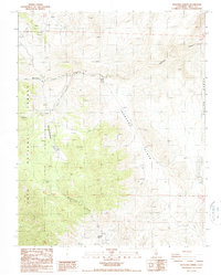
1987 Map of Waucoba Spring
USGS Topo · Published 1987About this map
Waucoba Spring serves as a critical watering point in this high-altitude desert landscape of the Inyo National Forest. The 1987 survey reveals an area defined by steep drainage systems and resource extraction, with numerous unnamed Prospects dotting the terrain from Marble Canyon in the north to the Saline Range in the east. The presence of the Opal Mine near Opal Canyon indicates the specific geological interests of the era, while the expansive Jackass Flats and Whippoorwill Flat provide the only level relief in an otherwise complex network of ridges. This map captures the intersection of federal land management and small-scale mining activity, where remote canyons like Waucoba Canyon and Whippoorwill Canyon descend toward the deeper basins beyond the forest boundary.
Find a feature on this map
17 named features on this map. Tap any name to fly to it.
Don’t see what you’re looking for? This feature index may not catch every label — zoom into the map to look around manually.
Map Details
Editions of this 1987 Waucoba Spring Map
2 editions found
Other maps of this area

1907 · Mt. Whitney
USGS Topo · 1:125,000

1908 · Lida
USGS Topo · 1:250,000

1908 · Ballarat
USGS Topo · 1:250,000

1913 · Bishop
USGS Topo · 1:125,000

1913 · Lida
USGS Topo · 1:250,000

1913 · Ballarat
USGS Topo · 1:250,000

1919 · Mt. Whitney
USGS Topo · 1:125,000

1937 · Mt. Whitney
USGS Topo · 1:125,000

1947 · Mariposa
USGS Topo · 1:250,000

1948 · Death Valley
USGS Topo · 1:250,000