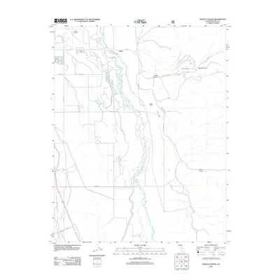
2012 Map of Poleta Canyon
USGS Topo · Published 2012About this map
The Owens River meanders through this valley landscape, defining the hydrological and agricultural character of the region east of the Inyo Mountains. The settlement of Poleta sits at the foot of Poleta Canyon, adjacent to the essential Bishop Creek Canal. This network of water management is further evidenced by the Rawson Canal, Collins Canal, and Geiger Canal, which divert water to sustain the arid terrain. Near the northern boundary, the Bishop Airport and the East Line Cem serve as prominent community landmarks, while the Poleta Picnic Area marks the transition into the higher elevations of Redding Canyon. The southern reach of the map features Saunders Lake and Warm Springs, illustrating a desert floor punctuated by localized water sources and seasonal drainages like Freeman Cr.
Find a feature on this map
28 named features on this map. Tap any name to fly to it.
Don’t see what you’re looking for? This feature index may not catch every label — zoom into the map to look around manually.
Map Details
Editions of this 2012 Poleta Canyon Map
This is the sole edition of this map. No revisions or reprints were ever made.
Other maps of this area

1913 · Bishop
USGS Topo · 1:125,000

1947 · Mariposa
USGS Topo · 1:250,000

1948 · Mariposa
USGS Topo · 1:250,000

1949 · Bishop
USGS Topo · 1:62,500

1950 · Big Pine
USGS Topo · 1:62,500

1951 · Bishop
USGS Topo · 1:62,500

1951 · Blanco Mountain
USGS Topo · 1:62,500

1951 · Waucoba Mtn.
USGS Topo · 1:62,500

1957 · Mariposa
USGS Topo · 1:250,000
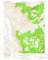
1958 · Waucoba Mtn
USGS Topo · 1:62,500