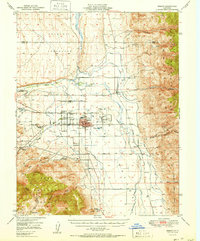
1951 Map of Bishop
USGS Topo · Published 1951About this map
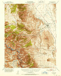
The Bishop city center is surrounded by an intricate network of irrigation canals and agriculture in this early 1950s survey. Key infrastructure such as the Municipal Airport, the Sewage Disposal plant, and the Paiute Shoshone Indian Reservation define the local geography. To the east and west, the landscape rises sharply into the White Mountain National Forest and Inyo National Forest, where a legacy of resource extraction is evident. Numerous mining operations, including the Southern Belle Mine (Freehold) and Poleta Mine USMM No 32, appear along the canyon slopes. Transportation is anchored by the Southern Pacific railroad line, which runs north toward Laws through the valley. The presence of Keough Hot Springs and Oteys Sierra Village reflects the early mid-century development of the Owens Valley as both a residential and industrial hub.
Find a feature on this map
50 named features on this map. Tap any name to fly to it.
Don’t see what you’re looking for? This feature index may not catch every label — zoom into the map to look around manually.
Map Details
Editions of this 1951 Bishop Map
This is the sole edition of this map. No revisions or reprints were ever made.
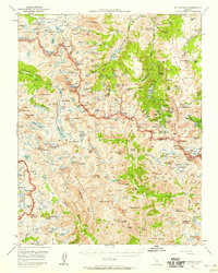
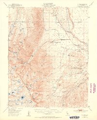
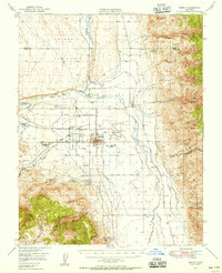
Other maps of this area

1912 · Mt. Goddard
USGS Topo · 1:125,000

1913 · Bishop
USGS Topo · 1:125,000

1914 · Mt. Morrison
USGS Topo · 1:125,000

1917 · White Mountain
USGS Topo · 1:125,000

1947 · Mariposa
USGS Topo · 1:250,000

1948 · Mariposa
USGS Topo · 1:250,000
1948 · Mt. Goddard
USGS Topo · 1:62,500
1949 · Mt. Tom
USGS Topo · 1:62,500
1949 · Bishop
USGS Topo · 1:62,500
1950 · Big Pine
USGS Topo · 1:62,500