
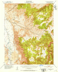
1951 Map of Waucoba Mtn.
USGS Topo · Published 1953About this map
The Owens River corridor and its industrial evolution are captured here in the early 1950s, showing a landscape defined by water management and mineral extraction. The presence of the Tinemaha Reservoir and Sanders Slough highlights the critical role of water in Inyo County, while the Southern Pacific (Dismantled) railroad tracks trace the path of former supply lines through the valley. High-altitude mining operations such as the Montezuma Mine, Blake Mine, and Riche Mine dot the slopes of the Inyo Mountains, linked by the winding Loretto Road.
Find a feature on this map
42 named features on this map. Tap any name to fly to it.
Don’t see what you’re looking for? This feature index may not catch every label — zoom into the map to look around manually.
Map Details
Editions of this 1951 Waucoba Mtn. Map
3 editions found
Other maps of this area

1907 · Mt. Whitney
USGS Topo · 1:125,000

1908 · Lida
USGS Topo · 1:250,000

1908 · Ballarat
USGS Topo · 1:250,000

1913 · Bishop
USGS Topo · 1:125,000

1913 · Lida
USGS Topo · 1:250,000

1913 · Ballarat
USGS Topo · 1:250,000

1919 · Mt. Whitney
USGS Topo · 1:125,000

1937 · Mt. Whitney
USGS Topo · 1:125,000

1947 · Mariposa
USGS Topo · 1:250,000

1948 · Death Valley
USGS Topo · 1:250,000