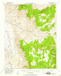
1951 Map of Waucoba Mtn
USGS Topo · Published 1958About this map
The high ridges of the Inyo Mountains dominate this 1951 landscape, defined by a stark contrast between the desert flats and towering peaks like Waucoba Mtn. In the valley, the Southern Pacific (Dismantled) Railroad runs parallel to the Owens River and the Tinemaha Reservoir, tracing the transport corridor that served the region's ranching and mining operations.
Find a feature on this map
45 named features on this map. Tap any name to fly to it.
Don’t see what you’re looking for? This feature index may not catch every label — zoom into the map to look around manually.
Map Details
Editions of this 1951 Waucoba Mtn Map
3 editions found

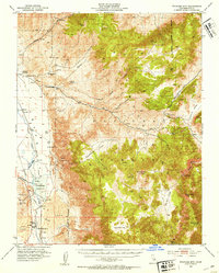
Other maps of this area

1907 · Mt. Whitney
USGS Topo · 1:125,000

1908 · Lida
USGS Topo · 1:250,000

1908 · Ballarat
USGS Topo · 1:250,000

1913 · Bishop
USGS Topo · 1:125,000

1913 · Lida
USGS Topo · 1:250,000

1913 · Ballarat
USGS Topo · 1:250,000

1919 · Mt. Whitney
USGS Topo · 1:125,000

1937 · Mt. Whitney
USGS Topo · 1:125,000

1947 · Mariposa
USGS Topo · 1:250,000

1948 · Death Valley
USGS Topo · 1:250,000