
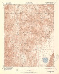
1951 Map of Blanco Mountain
USGS Topo · Published 1953About this map
The Inyo Mountains define the high-elevation landscape of this 1951 survey, where the rugged peaks of Blanco Mtn and Red Peak rise above the high desert terrain. This era represents a period of diverse activity within the Inyo National Forest, from the high-altitude Naval Research Station near Campito Mtn to the isolated cattle operations at Roberts Ranch. The geography is shaped by the transition from the steep canyons of the range into the arid expanse of Deep Spring Valley, home to the seasonal Deep Spring Lake.
Find a feature on this map
53 named features on this map. Tap any name to fly to it.
Don’t see what you’re looking for? This feature index may not catch every label — zoom into the map to look around manually.
Map Details
Editions of this 1951 Blanco Mountain Map
5 editions found
Other maps of this area

1898 · Silver Peak
USGS Topo · 1:125,000

1900 · Silver Peak
USGS Topo · 1:125,000

1908 · Lida
USGS Topo · 1:250,000

1913 · Bishop
USGS Topo · 1:125,000

1913 · Lida
USGS Topo · 1:250,000

1917 · White Mountain
USGS Topo · 1:125,000

1947 · Mariposa
USGS Topo · 1:250,000

1948 · Mariposa
USGS Topo · 1:250,000

1949 · Bishop
USGS Topo · 1:62,500

1950 · Big Pine
USGS Topo · 1:62,500