
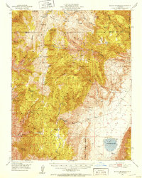
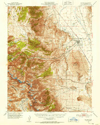
1951 Map of Blanco Mountain
USGS Topo · Published 1958About this map
Roberts Ridge and the surrounding high-altitude terrain of the Inyo National Forest dominate this mid-century survey, revealing a landscape defined by isolation and mineral exploration. The presence of the Naval Research Station near Sage Hen Flat and the Radio Relay Sta atop the peaks suggests the region's importance for specialized scientific and communications infrastructure during the 1950s. Mining activity is scattered throughout the canyons, with the Wilkerson Mine, Mollie Gibson Mines, and Grandview Mine marking the efforts to extract wealth from these mountains.
Find a feature on this map
70 named features on this map. Tap any name to fly to it.
Don’t see what you’re looking for? This feature index may not catch every label — zoom into the map to look around manually.
Map Details
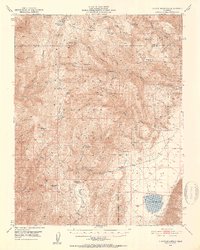
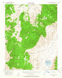
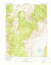
Editions of this 1951 Blanco Mountain Map
5 editions found
Other maps of this area

1898 · Silver Peak
USGS Topo · 1:125,000

1900 · Silver Peak
USGS Topo · 1:125,000

1908 · Lida
USGS Topo · 1:250,000

1913 · Bishop
USGS Topo · 1:125,000

1913 · Lida
USGS Topo · 1:250,000

1917 · White Mountain
USGS Topo · 1:125,000

1947 · Mariposa
USGS Topo · 1:250,000

1948 · Mariposa
USGS Topo · 1:250,000
1949 · Bishop
USGS Topo · 1:62,500
1950 · Big Pine
USGS Topo · 1:62,500