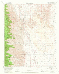
1954 Map of Little Lake
USGS Topo · Published 1972About this map
Rose Valley serves as a narrow corridor for vital California infrastructure in this mid-century survey, where the Southern Pacific railroad and a major Pipe Line run parallel through the high desert. The small settlements of Little Lake, Linnie, and Brown are positioned along this transit spine, which is flanked to the west by the steep elevations of Sawtooth Peak and Boulder Peak. Notable for archaeological interest, the map identifies Indian Petroglyphs east of the valley, while the presence of a Cinder Pit and Gravel Pit indicates the era's local extractive industry. The drainage patterns are clearly defined through numerous named canyons, including Fivemile Canyon and Ninemile Canyon, which feed into the valley floor near the Los Angeles Aqueduct. This survey captures the region just as the eastern boundary was being formalized as part of a Naval Reservation.
Find a feature on this map
40 named features on this map. Tap any name to fly to it.
Don’t see what you’re looking for? This feature index may not catch every label — zoom into the map to look around manually.
Map Details
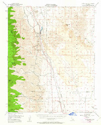
Editions of this 1954 Little Lake Map
3 editions found

Other maps of this area

1905 · Olancha
USGS Topo · 1:125,000

1906 · Kernville
USGS Topo · 1:125,000

1907 · Olancha
USGS Topo · 1:125,000

1908 · Kernville
USGS Topo · 1:125,000

1908 · Ballarat
USGS Topo · 1:250,000

1913 · Ballarat
USGS Topo · 1:250,000

1915 · Searles Lake
USGS Topo · 1:250,000

1943 · Inyokern
USGS Topo · 1:62,500

1943 · Onyx
USGS Topo · 1:62,500

1947 · Trona
USGS Topo · 1:250,000