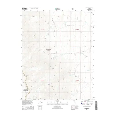
2015 Map of Aberdeen
USGS Topo · Published 2015About this map
Owens Valley meets the high eastern slopes of the Sierra Nevada in this topographical study centered on the small settlement of Aberdeen. The transition from the valley floor to the high peaks is marked by dramatic terrain features such as The Hogsback, Shingle Mill Bench, and Colosseum Mtn. For those interested in the natural hydrology of the region, the map meticulously records the descent of Taboose Cr, Goodale Cr, and Division Cr from the high country into the basin.
Find a feature on this map
37 named features on this map. Tap any name to fly to it.
Don’t see what you’re looking for? This feature index may not catch every label — zoom into the map to look around manually.
Map Details
Editions of this 2015 Aberdeen Map
This is the sole edition of this map. No revisions or reprints were ever made.
Other maps of this area

1907 · Mt. Whitney
USGS Topo · 1:125,000

1913 · Bishop
USGS Topo · 1:125,000

1919 · Mt. Whitney
USGS Topo · 1:125,000

1937 · Mt. Whitney
USGS Topo · 1:125,000

1947 · Mariposa
USGS Topo · 1:250,000

1948 · Fresno
USGS Topo · 1:250,000

1948 · Mariposa
USGS Topo · 1:250,000

1950 · Big Pine
USGS Topo · 1:62,500

1951 · Waucoba Mtn.
USGS Topo · 1:62,500

1951 · Independence
USGS Topo · 1:62,500