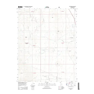
2015 Map of Fish Springs
USGS Topo · Published 2015About this map
Inyo National Forest dominates the western half of this Owens Valley landscape, where steep slopes descend toward the settled corridor of the east. The settlement of Fish Springs sits at the foot of Fish Springs Hill, positioned near the Big Pine Canal and the agricultural infrastructure of the valley floor. The geography is defined by a series of prominent volcanic and alluvial features, including the Poverty Hills, Crater Mtn, and Red Mtn, which punctuate the transition from the high eastern Sierra to the valley basin. A network of mountain roads such as McMurry Meadows Rd and Birch Creek Rd provide access to the upland meadows. Water management is central to the area's layout, with several drainages like Tinemaha Cr and Taboose Cr flowing eastward toward the canal system, illustrating the vital intersection of mountain snowmelt and valley irrigation.
Find a feature on this map
31 named features on this map. Tap any name to fly to it.
Don’t see what you’re looking for? This feature index may not catch every label — zoom into the map to look around manually.
Map Details
Editions of this 2015 Fish Springs Map
This is the sole edition of this map. No revisions or reprints were ever made.
Other maps of this area

1907 · Mt. Whitney
USGS Topo · 1:125,000

1913 · Bishop
USGS Topo · 1:125,000

1919 · Mt. Whitney
USGS Topo · 1:125,000

1937 · Mt. Whitney
USGS Topo · 1:125,000

1947 · Mariposa
USGS Topo · 1:250,000

1948 · Fresno
USGS Topo · 1:250,000

1948 · Mariposa
USGS Topo · 1:250,000

1950 · Big Pine
USGS Topo · 1:62,500

1951 · Waucoba Mtn.
USGS Topo · 1:62,500

1951 · Independence
USGS Topo · 1:62,500