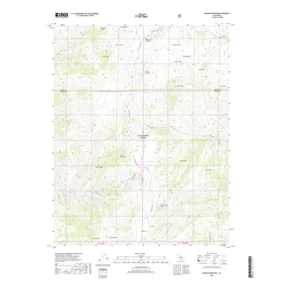
2018 Map of Blanco Mountain
USGS Topo · Published 2018About this map
The White-Inyo Range dominates this portion of the Inyo National Forest, where high-altitude peaks and secluded canyons define the landscape. Notable elevations include Blanco Mtn, Campito Mtn, and Clem Nelson Peak, surrounded by distinctive topographic basins such as Sage Hen Flat and Big Prospector Meadow. The presence of the Mollie Gibson Mine in the southern reaches highlights the area's history of mineral exploration, accessed via the winding White Mtn Road. Water sources are sparse but critical, represented by several perennial outflows like Coldwater Spring, Goat Spring, and Cedar Spring. The map captures a rugged transition across the Mono and Inyo county lines, illustrating a wilderness where drainage systems like Silver Canyon and Crooked Creek carve deep paths through the mountainous terrain.
Find a feature on this map
35 named features on this map. Tap any name to fly to it.
Don’t see what you’re looking for? This feature index may not catch every label — zoom into the map to look around manually.
Map Details
Editions of this 2018 Blanco Mountain Map
This is the sole edition of this map. No revisions or reprints were ever made.
Other maps of this area

1913 · Bishop
USGS Topo · 1:125,000

1917 · White Mountain
USGS Topo · 1:125,000

1947 · Mariposa
USGS Topo · 1:250,000

1948 · Mariposa
USGS Topo · 1:250,000

1949 · Bishop
USGS Topo · 1:62,500

1951 · Bishop
USGS Topo · 1:62,500

1951 · Blanco Mountain
USGS Topo · 1:62,500

1957 · Mariposa
USGS Topo · 1:250,000

1962 · Mt. Barcroft
USGS Topo · 1:62,500

1962 · White Mtn. Peak
USGS Topo · 1:62,500