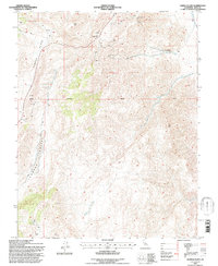
1994 Map of Joshua Flats
USGS Topo · Published 1997About this map
Nikolaus Eureka Mine and the Harlis and Broady Mine anchor this high-altitude landscape in the Inyo County mountains during the 1990s. The terrain is defined by a series of steep ridges and deep valleys, most notably Cowhorn Valley and the eponymous Joshua Flats. The map reveals a history of active resource extraction, indicated by numerous scattered Prospects, a Quarry, and a Borrow Pit.
Find a feature on this map
12 named features on this map. Tap any name to fly to it.
Don’t see what you’re looking for? This feature index may not catch every label — zoom into the map to look around manually.
Map Details
Editions of this 1994 Joshua Flats Map
This is the sole edition of this map. No revisions or reprints were ever made.
Other maps of this area

1908 · Lida
USGS Topo · 1:250,000

1913 · Bishop
USGS Topo · 1:125,000

1913 · Lida
USGS Topo · 1:250,000

1947 · Mariposa
USGS Topo · 1:250,000

1948 · Mariposa
USGS Topo · 1:250,000

1951 · Blanco Mountain
USGS Topo · 1:62,500

1951 · Waucoba Mtn.
USGS Topo · 1:62,500

1954 · Goldfield
USGS Topo · 1:250,000

1955 · Goldfield
USGS Topo · 1:250,000

1957 · Mariposa
USGS Topo · 1:250,000