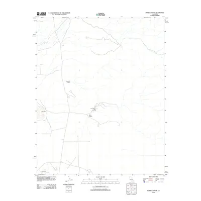
2012 Map of Burro Canyon
USGS Topo · Published 2012About this map
Burro Canyon Test Facility and Paxton Ranch represent the sparse human footprint in this arid San Bernardino County landscape. The terrain is defined by dry drainage systems such as Sweetwater Wash and Deadman Canyon, which cut through the high desert. At the southern edge, the boundary of China Lake points to the area's significance for specialized research and testing. The network of unimproved roads and 4WD tracks suggests a region utilized for tactical operations and ranching activities, where topography like Burro Canyon dictates the path of travel. This 2012 survey documents the intersection of private landholdings and extensive government-managed territory, reflecting the specialized land use typical of the eastern Mojave region.
Find a feature on this map
6 named features on this map. Tap any name to fly to it.
Don’t see what you’re looking for? This feature index may not catch every label — zoom into the map to look around manually.
Map Details
Editions of this 2012 Burro Canyon Map
This is the sole edition of this map. No revisions or reprints were ever made.
Other maps of this area

1915 · Searles Lake
USGS Topo · 1:250,000

1947 · Trona
USGS Topo · 1:250,000

1948 · Trona
USGS Topo · 1:250,000

1949 · Trona
USGS Topo · 1:62,500

1949 · Searles Lake
USGS Topo · 1:62,500

1950 · Searles Lake
USGS Topo · 1:62,500

1950 · Trona
USGS Topo · 1:62,500

1953 · Mountain Springs Canyon
USGS Topo · 1:62,500

1953 · Ridgecrest
USGS Topo · 1:62,500

1953 · Trona
USGS Topo · 1:250,000