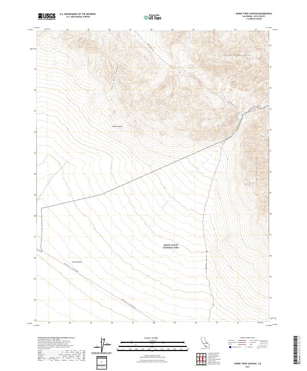
2021 Map of Horse Thief Canyon
USGS Topo · Published 2021About this map
Death Valley National Park occupies the southern reaches of this arid landscape, where the northern floor of Eureka Valley meets the rising elevations of the Sylvania Mountains. This 2021 survey traces the vital backcountry arteries that cross the High Desert, most notably the Death Valley / Big Pine Road which cuts across the valley floor. The topography is defined by dramatic drainage systems like Horse Thief Canyon and Cucomungo Canyon, which channel occasional runoff from the high peaks toward the lowlands of the Mojave Desert. To the east, the steep gradients of the Last Chance Range form a formidable natural barrier. Water remains the primary architect of the land here, evidenced by the winding courses of Willow Wash and Willow Creek, highlighting the sparse but essential hydrography of this Inyo County wilderness.
Find a feature on this map
16 named features on this map. Tap any name to fly to it.
Don’t see what you’re looking for? This feature index may not catch every label — zoom into the map to look around manually.
Map Details
Editions of this 2021 Horse Thief Canyon Map
This is the sole edition of this map. No revisions or reprints were ever made.
Other maps of this area

1908 · Lida
USGS Topo · 1:250,000

1913 · Lida
USGS Topo · 1:250,000

1954 · Goldfield
USGS Topo · 1:250,000

1955 · Goldfield
USGS Topo · 1:250,000

1957 · Magruder Mtn
USGS Topo · 1:62,500

1958 · Goldfield
USGS Topo · 1:250,000

1958 · Last Chance Range
USGS Topo · 1:62,500

1958 · Soldier Pass
USGS Topo · 1:62,500
1958 · Waucoba Spring
USGS Topo · 1:62,500

1962 · Goldfield
USGS Topo · 1:250,000