
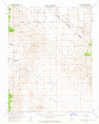
1958 Map of Soldier Pass
USGS Topo · Published 1959About this map
White Mtn City (Ruin) and the high-desert outpost of Oasis anchor this mid-century survey of the California-Nevada borderlands. The landscape is defined by the sharp transition between the White Mts and the expansive Eureka Valley, where survival relied on the few water sources like Deep Springs Lake and the Jr College at Deep Springs. The map documents a rugged mining economy with operations like the Copper Queen Mine, Sierra Talc & Mine, and Victor Cons Mine scattered across the Sylvania Mts and Last Chance Range. Cultural history is noted through ancient Petroglyphs and the precise path of the Von Schmidt Line, which established the state boundary. Remote tracks and a Jeep Trail wind through Soldier Pass Canyon, connecting isolated settlements and mining claims in this arid basin-and-range terrain.
Find a feature on this map
44 named features on this map. Tap any name to fly to it.
Don’t see what you’re looking for? This feature index may not catch every label — zoom into the map to look around manually.
Map Details
Editions of this 1958 Soldier Pass Map
2 editions found
Other maps of this area

1898 · Silver Peak
USGS Topo · 1:125,000

1900 · Silver Peak
USGS Topo · 1:125,000

1908 · Lida
USGS Topo · 1:250,000

1913 · Bishop
USGS Topo · 1:125,000

1913 · Lida
USGS Topo · 1:250,000

1917 · White Mountain
USGS Topo · 1:125,000

1947 · Mariposa
USGS Topo · 1:250,000

1948 · Mariposa
USGS Topo · 1:250,000

1951 · Blanco Mountain
USGS Topo · 1:62,500

1951 · Waucoba Mtn.
USGS Topo · 1:62,500