
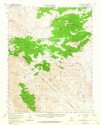
1957 Map of Magruder Mtn
USGS Topo · Published 1959About this map
The high desert landscape of the Palmetto Mountains and Sylvania Mountains dominates this 1950s survey of the California-Nevada border. Evidence of historic mining activity is scattered across the terrain, from the Sylvania Mine and Blue Dick Mine to numerous unnamed shafts and tunnels. Near the northern edge, the remnants of Palmetto are marked by ruins and a lone Grave, suggesting a settlement that had already begun to recede into the landscape.
Find a feature on this map
50 named features on this map. Tap any name to fly to it.
Don’t see what you’re looking for? This feature index may not catch every label — zoom into the map to look around manually.
Map Details
Editions of this 1957 Magruder Mtn Map
2 editions found
Other maps of this area

1898 · Silver Peak
USGS Topo · 1:125,000

1900 · Silver Peak
USGS Topo · 1:125,000

1908 · Lida
USGS Topo · 1:250,000

1913 · Lida
USGS Topo · 1:250,000

1945 · Goldfield
USGS Topo · 1:125,000

1954 · Goldfield
USGS Topo · 1:250,000

1955 · Goldfield
USGS Topo · 1:250,000

1957 · Ubehebe Crater
USGS Topo · 1:62,500

1958 · Goldfield
USGS Topo · 1:250,000

1958 · Last Chance Range
USGS Topo · 1:62,500