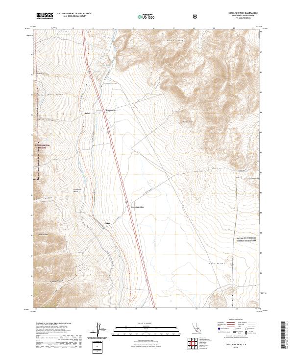
2021 Map of Coso Junction
USGS Topo · Published 2021About this map
The Los Angeles Aqueduct and Second Los Angeles Aqueduct parallel the eastern edge of the Sierra Nevada in this high desert landscape. These massive hydraulic projects define the corridor between Rose Valley and the Haiwee Ridge, feeding the distant metropolis. Near the transit route of Highway 395, small named sites like Coso Junction, Dunmovin, Talus, and Sykes mark the thin line of human presence in the Mojave Desert.
Find a feature on this map
30 named features on this map. Tap any name to fly to it.
Don’t see what you’re looking for? This feature index may not catch every label — zoom into the map to look around manually.
Map Details
Editions of this 2021 Coso Junction Map
This is the sole edition of this map. No revisions or reprints were ever made.
Other maps of this area

1905 · Olancha
USGS Topo · 1:125,000

1906 · Kernville
USGS Topo · 1:125,000

1907 · Olancha
USGS Topo · 1:125,000

1908 · Kernville
USGS Topo · 1:125,000

1908 · Ballarat
USGS Topo · 1:250,000

1913 · Ballarat
USGS Topo · 1:250,000

1915 · Searles Lake
USGS Topo · 1:250,000

1947 · Trona
USGS Topo · 1:250,000

1948 · Trona
USGS Topo · 1:250,000

1948 · Death Valley
USGS Topo · 1:250,000