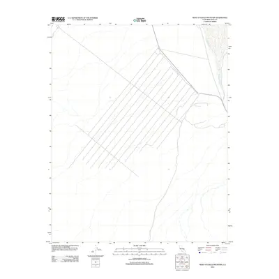
2012 Map of West of Eagle Mountain
USGS Topo · Published 2012About this map
The Amargosa River traces a north-south path through this arid basin in Inyo County, defining the drainage patterns of this desert landscape. This area, situated just west of the Eagle Mountain formation, is characterized by a network of braided seasonal channels and alluvial fan structures that drain toward the riverbed. The map illustrates a distinctive pattern of surveyed lines and tracks that converge near the state border, suggesting specialized land use or infrastructure development in this remote sector of the California-Nevada boundary. Despite its sparse population, the presence of the Amargosa River highlights the essential role of even intermittent water sources in shaping the geography of the Mojave region during the early 21st century.
Find a feature on this map
1 named feature on this map. Tap any name to fly to it.
Don’t see what you’re looking for? This feature index may not catch every label — zoom into the map to look around manually.
Map Details
Editions of this 2012 West of Eagle Mountain Map
This is the sole edition of this map. No revisions or reprints were ever made.
Other maps of this area

1908 · Furnace Creek
USGS Topo · 1:250,000

1910 · Furnace Creek
USGS Topo · 1:250,000

1940 · Eagle Tank
USGS Topo · 1:62,500

1948 · Death Valley
USGS Topo · 1:250,000

1951 · Funeral Peak
USGS Topo · 1:62,500

1951 · Eagle Mtn
USGS Topo · 1:62,500

1952 · Ash Meadows
USGS Topo · 1:62,500

1952 · Ryan
USGS Topo · 1:62,500

1954 · Death Valley
USGS Topo · 1:250,000

1956 · Death Valley
USGS Topo · 1:250,000