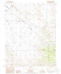
1987 Map of Sylvania Canyon
USGS Topo · Published 1987About this map
The VON Schmidt Line cuts a historic path across this high-altitude landscape, marking the complex boundary between Nevada and California. This 1987 survey documents the rugged intersection of the Sylvania Mountains and the arid expanse of Fish Lake Valley. The map records a series of survey monuments along the border, including State Boundary Mon 75 and State Boundary Mon 76, which trace the legacy of early western boundary disputes and geographical definition. Evidence of the region's mineral history is visible through high-country mining operations like the Sierra Mine and Oasis Mine, located near the head of Sylvania Canyon. The drainage of Palmetto Wash further defines the terrain, illustrating the remote and difficult environment that surveyors and miners navigated throughout the late 20th century.
Find a feature on this map
18 named features on this map. Tap any name to fly to it.
Don’t see what you’re looking for? This feature index may not catch every label — zoom into the map to look around manually.
Map Details
Editions of this 1987 Sylvania Canyon Map
This is the sole edition of this map. No revisions or reprints were ever made.
Other maps of this area

1898 · Silver Peak
USGS Topo · 1:125,000

1900 · Silver Peak
USGS Topo · 1:125,000

1908 · Lida
USGS Topo · 1:250,000

1913 · Lida
USGS Topo · 1:250,000

1954 · Goldfield
USGS Topo · 1:250,000

1955 · Goldfield
USGS Topo · 1:250,000

1957 · Magruder Mtn
USGS Topo · 1:62,500

1958 · Goldfield
USGS Topo · 1:250,000

1958 · Soldier Pass
USGS Topo · 1:62,500

1962 · Goldfield
USGS Topo · 1:250,000