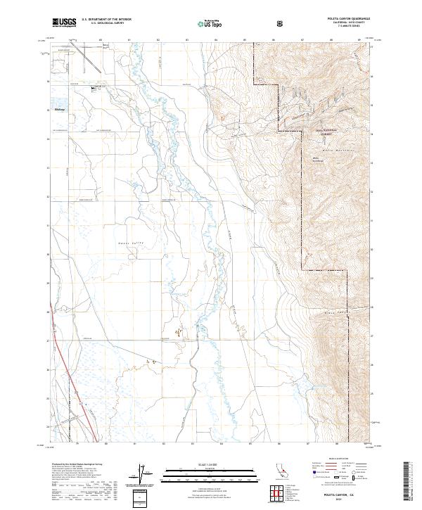
2021 Map of Poleta Canyon
USGS Topo · Published 2021About this map
The Owens River winds through the heart of the Owens Valley in this survey of the high desert landscape east of Bishop. The western edge of the map captures the transition from the valley floor to the base of the White Mountains, where the intricate network of the Bishop Creek Canal, Geiger Canal, and Collins Canal underscores the region’s long-standing reliance on managed water systems.
Find a feature on this map
42 named features on this map. Tap any name to fly to it.
Don’t see what you’re looking for? This feature index may not catch every label — zoom into the map to look around manually.
Map Details
Editions of this 2021 Poleta Canyon Map
This is the sole edition of this map. No revisions or reprints were ever made.
Other maps of this area

1913 · Bishop
USGS Topo · 1:125,000

1947 · Mariposa
USGS Topo · 1:250,000

1948 · Mariposa
USGS Topo · 1:250,000

1949 · Bishop
USGS Topo · 1:62,500

1950 · Big Pine
USGS Topo · 1:62,500

1951 · Bishop
USGS Topo · 1:62,500

1951 · Blanco Mountain
USGS Topo · 1:62,500

1951 · Waucoba Mtn.
USGS Topo · 1:62,500

1957 · Mariposa
USGS Topo · 1:250,000
1958 · Waucoba Mtn
USGS Topo · 1:62,500