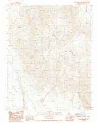
1987 Map of Hanging Rock Canyon
USGS Topo · Published 1987About this map
Last Chance Range dominates this mid-1980s landscape, where steep topography transitions sharply into the broad expanse of Eureka Valley. The map reveals an area defined by mineral exploration and high-desert infrastructure, characterized by numerous prospects and open pit mines scattered across the ridgelines. Of particular interest to historians is Crater (Site), appearing as a named location tucked within the range near several extraction points. The network of 4wd tracks provides the only access through Hanging Rock Canyon, illustrating the isolation of these industrial sites. In addition to mining for materials like lead, the map identifies several vertical flight data targets, such as Vfdt 9-258, indicating the region’s use for aerial survey and geodetic control in the latter half of the 20th century.
Find a feature on this map
23 named features on this map. Tap any name to fly to it.
Don’t see what you’re looking for? This feature index may not catch every label — zoom into the map to look around manually.
Map Details
Editions of this 1987 Hanging Rock Canyon Map
This is the sole edition of this map. No revisions or reprints were ever made.
Other maps of this area

1908 · Lida
USGS Topo · 1:250,000

1913 · Lida
USGS Topo · 1:250,000

1954 · Goldfield
USGS Topo · 1:250,000

1955 · Goldfield
USGS Topo · 1:250,000

1957 · Magruder Mtn
USGS Topo · 1:62,500

1958 · Goldfield
USGS Topo · 1:250,000

1958 · Last Chance Range
USGS Topo · 1:62,500

1958 · Soldier Pass
USGS Topo · 1:62,500
1958 · Waucoba Spring
USGS Topo · 1:62,500

1962 · Goldfield
USGS Topo · 1:250,000