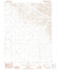
1987 Map of Horse Thief Canyon
USGS Topo · Published 1987About this map
The Sylvania Mts dominate the northern skyline of this high desert terrain, where the topography drops dramatically toward the expansive floor of Eureka Valley. This transition between mountain and basin is defined by deep drainages and alluvial fans, most notably where Horse Thief Canyon and Willow Creek carve through the arid slopes. Evidence of small-scale mineral exploration is recorded at a remote Prospect and a Borrow Pit, hinting at the region's history of prospecting during the late 20th century. Along the eastern edge, the Last Chance Range forms a formidable boundary, while the seasonal flow of Cucomungo Canyon marks the rugged eastern canyons. The map serves as a detailed record of this uninhabited California landscape, capturing the precise contours and watercourses of Inyo County before the era of modern digital mapping.
Find a feature on this map
10 named features on this map. Tap any name to fly to it.
Don’t see what you’re looking for? This feature index may not catch every label — zoom into the map to look around manually.
Map Details
Editions of this 1987 Horse Thief Canyon Map
This is the sole edition of this map. No revisions or reprints were ever made.
Other maps of this area

1908 · Lida
USGS Topo · 1:250,000

1913 · Lida
USGS Topo · 1:250,000

1954 · Goldfield
USGS Topo · 1:250,000

1955 · Goldfield
USGS Topo · 1:250,000

1957 · Magruder Mtn
USGS Topo · 1:62,500

1958 · Goldfield
USGS Topo · 1:250,000

1958 · Last Chance Range
USGS Topo · 1:62,500

1958 · Soldier Pass
USGS Topo · 1:62,500
1958 · Waucoba Spring
USGS Topo · 1:62,500

1962 · Goldfield
USGS Topo · 1:250,000